A series of environmental notices filed with the state shed light on how Metro will use a $139-million federal grant to improve access to transit hubs across Los Angeles County in advance of the 2028 Summer Olympic games.
Broadly speaking, the money is expected to go to projects that improve bus speed and service reliability, as well as new mobility hubs, and first/last mile infrastructure. Total improvements will include:
- 14 miles of bus priority lanes;
- 23 miles of bus corridor enhancements; and
- 60 Metro Bike Share stations.
Per a staff presentation at a recent meeting of the Metro Board's Ad Hoc 2028 Olympic & Paralympic Games Committee, specific projects will include:
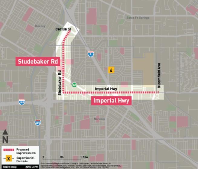
3.4 miles of bus priority lanes on Imperial Highway and Studebaker Road in the City of Norwalk, bridging the gap between the Norwalk C Line station and Metrolink’s Norwalk/Santa Fe Springs Station. Plans also call for new bus bulb-outs and shelters.
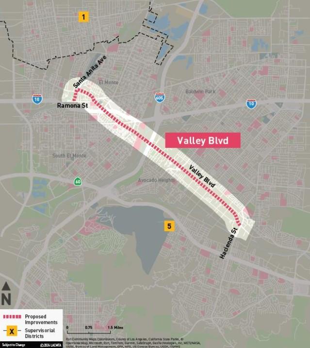
6.6 miles of bus priority lanes on Valley Boulevard and Santa Anita Avenue in El Monte, the City of Industry, and unincorporated Avocado Heights, including a connection to the EL Monte Transit Center on its western end, new bus shelters, and traffic signal upgrades as needed.
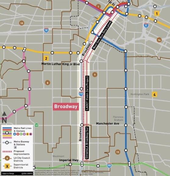
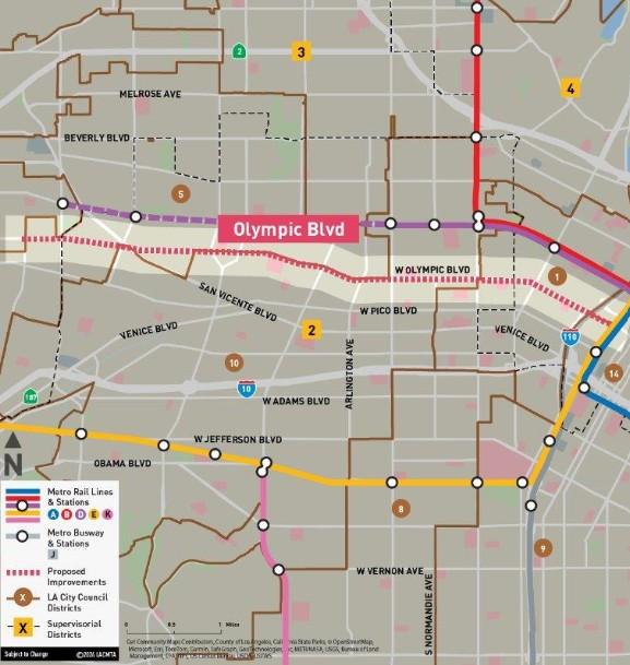
Additionally, "bus corridor enhancements," are planned for three major corridors, with improved speeds to be achieved through implementation of transit signal priority and all-door boarding. Other physical improvements would include bus bulb-outs, concrete bus pads, bus shelters, bicycle racks, signage, lighting, street trees, landscaping, sidewalk and curb ramp repair, and other bus stop amenities. The corridors are:
9 miles of Broadway between 1st Street in Downtown Los Angeles and Imperial Highway in South Los Angeles
7 miles of Olympic Boulevard between Figueroa Street in Downtown and Robertson Boulevard in Pico-Robertson
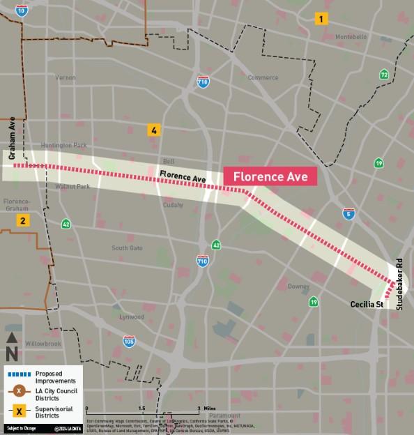
9.5 miles on Florence Avenue and Studebaker Road through Bell, Bell Gardens, Downey, Huntington Park, and the unincorporated communities of Florence-Firestone and Walnut Park
First/last mile improvements are planned on several corridors, including:
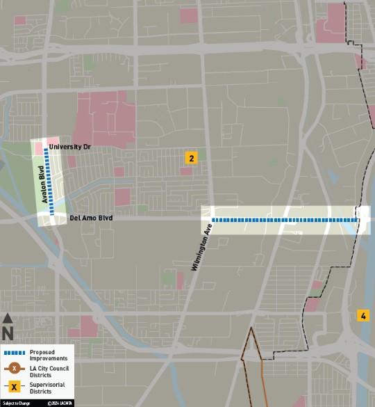
1.5 miles of Wilmington Avenue to South Susana Road in Carson and unincorporated Los Angeles County, including Class IV separated bikeways, new lighting and pedestrian signals, high-visibility sidewalks, bus bulbs/islands, bus and bus shelters.
1 mile of Class IV bikeway on Avalon Boulevard between Del Amo Boulevard and University Drive in Carson, as well as refuge islands, high-visibility crosswalks, and other safety improvements.
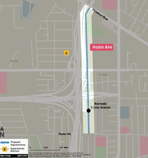
0.75 miles of improvements to Hoxie Avenue from Firestone Boulevard to Foster Road in Norwalk, providing a Class IV separated bikeway and other safety upgrades to connect with Metro's C Line.
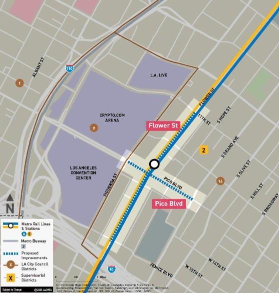
0.5 miles of improvements to Flower Street from Venice Boulevard to West 11th Street, including a Class III shared bus-bike lane, the conversion of existing peak-hour bus lanes to full-time lanes, and improvements to pedestrian infrastructure
0.25 miles of Pico Boulevard from Figueroa Street to Grand Avenue with Class II and Class IV bikeways and new pedestrian infrastructure.
Finally, new "mobility hubs" are planned at five stations, incorporating elements including wayfinding signage, informational kiosks, intersection crossings and sidewalk improvements, rail crossing improvements, pedestrian lighting, trees and landscaping, furniture, micromobility storage and bike/scooter share, wi-fi, and device charging docks. The stations are:
- Chatsworth Station (served by Metrolink, Amtrak, the G Line, and various local bus lines);
- North Hollywood Station (served by the B Line, the G Line, and various local bus lines);
- Expo/Crenshaw Station - served by the E Line and the K Line;
- Willow Station; connecting the A Line with local and regional buses; and
- El Monte Station; served by the J Line, numerous local and regional buses, and located near the Metrolink El Monte Station.
Follow us on social media:
Twitter / Facebook / LinkedIn / Threads / Instagram / Bluesky


