Earlier this year, the City of San Dimas filed a lawsuit against the Foothill Gold Line Construction Authority which could force L Line trains to temporarily skip San Dimas Station on its eastward path toward Pomona. That makes this next bit of news a bit awkward.
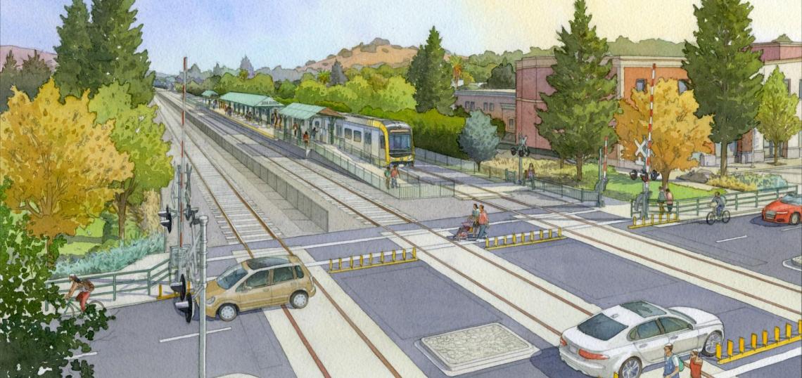
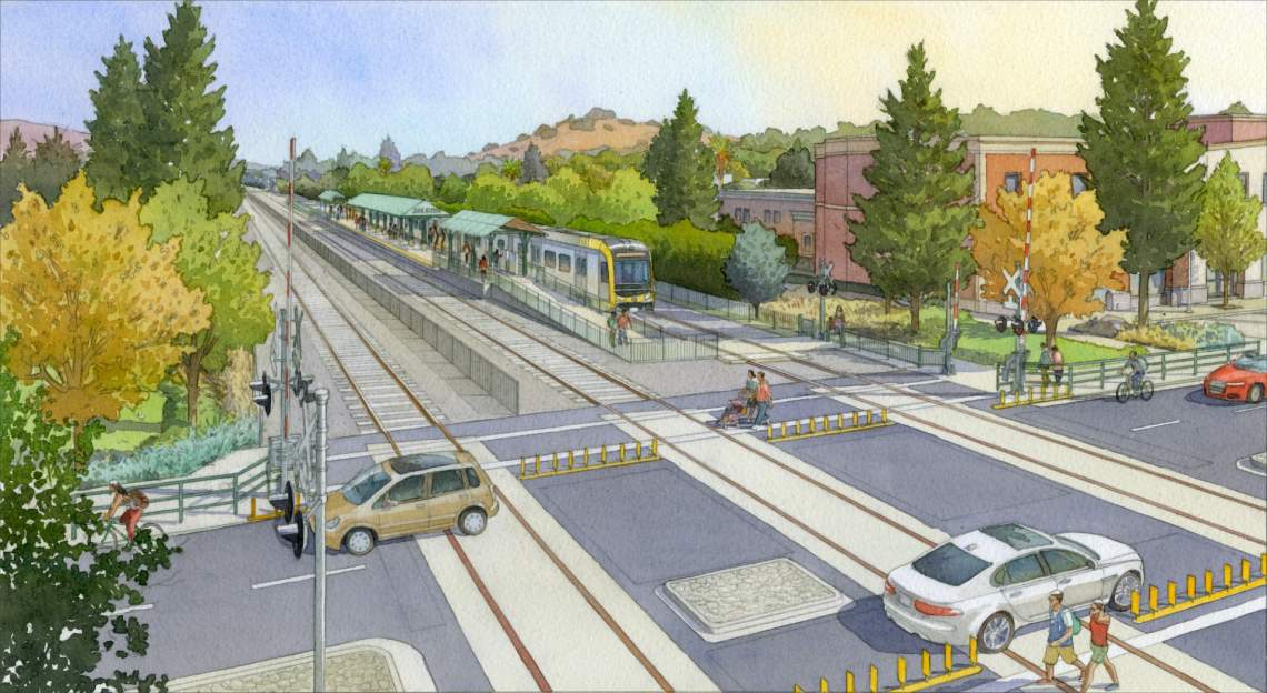 Illustration of San Dimas StationMetro Gold Line Foothill Extension Construction Authority
This week, the San Dimas Planning Division kicked off the environmental review process for its new Downtown Specific Plan, which aims to use the light rail stop at the center of the city's lawsuit to foster the construction of new housing and commercial uses nearby.
The specific plan area, centered on Bonita Avenue, spans east to west between Gaffney Street and the 57 Freeway and north to south between First Street and Arrow Highway. The train station, located on the east side of San Dimas Avenue to the south of Bonita, would anchor the district, which is also home to San Dimas City Hall and other municipal facilities.
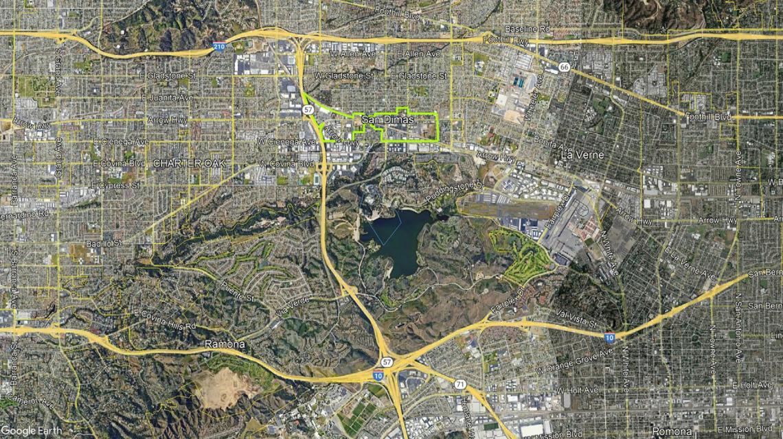 San Dimas Downtown Specific Plan AreaGoogle Maps
The proposed specific plan would include six different districts, each with distinct development standards and goals. They include:
- Gateway Village West: Located between the 57 Freeway and Cataract Avenue, the Gateway Village West zone would accommodate residential and commercial uses under a single roof, as well as community-serving open space and amenities.
- Gateway Village East: Situated between Gaffney Street and Walnut Avenue, the Gateway East Zone is described as a transition zone between the Downtown core and lower-scale neighborhoods to the east.
- Transit Village: Focused on the blocks directly adjacent to the station, the Transit Village zone is envisioned with residential, commercial, retail, and restaurant uses of similar scale and density to the Grove Station development at 182 S. Commercial Street.
- Town Core: Comprising the commercial core of San Dimas along Bonita Avenue between Cataract and San Dimas Avenue, the Town Core Zone is intended to retain historic buildings with pedestrian-oriented uses at street level. New construction in the area would be required to match the form and site design of existing construction.
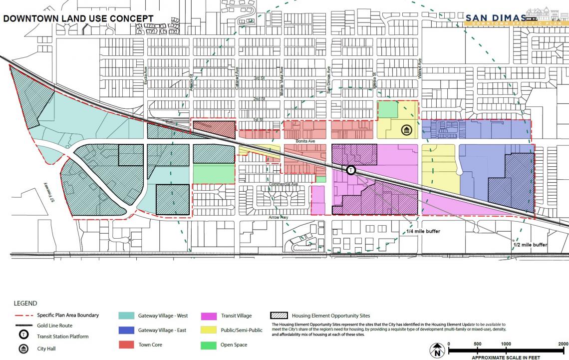 San Dimas Downtown Specific Plan land use conceptsCity of San Dimas
Also included are Public and Open Space zones, which pertain to the San Dimas Civic Center and Civic Center Park properties.
While the exact development potential of the specific plan is not stated, the plan area notably includes 14 sites which the city has identified for potential development as part of its 2021-2029 Housing Element update, which requires San Dimas to rezone to accommodate 1,248 new homes - nearly half of which must be affordable to low- and very low-income households.
The lawsuit against the Gold Line Construction Authority, filed in August, relates to the condemnation of an existing park-and-ride lot at the intersection of San Dimas Avenue and Railway Street, which would be expanded to serve Metro rail passengers. The Daily News reports that the decision to condemn the park-and-ride lot was originally suggested by San Dimas city officials, which objected to an earlier plan to convert a nearby maintenance yard into parking.
 Map of the Foothill Gold Line ExtensionMetro
While reports indicate that both the Construction Authority and the city may come to a settlement agreement, a prolonged legal dispute could mean delays for the L Line extension, which is scheduled to begin service in 2025. In that event, Metro trains may initially skip San Dimas entirely to keep the project on track.