Los Angeles County has released a draft transit oriented specific plan that would facilitate the construction of up to 1,000 residential units and 1.7 million square feet of commercial development in the community surrounding Metro's Vermont/Athens Station.
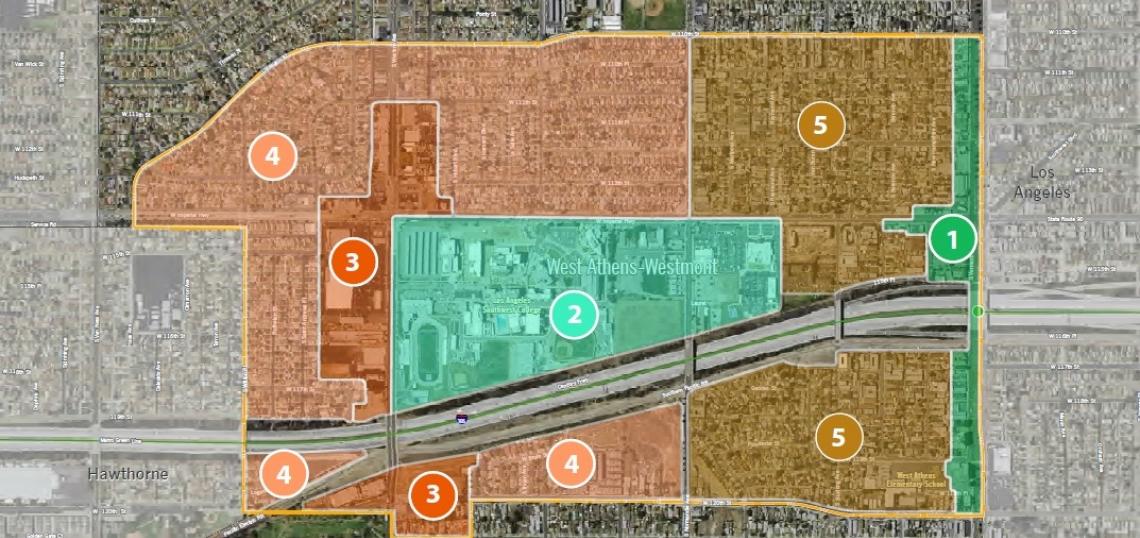
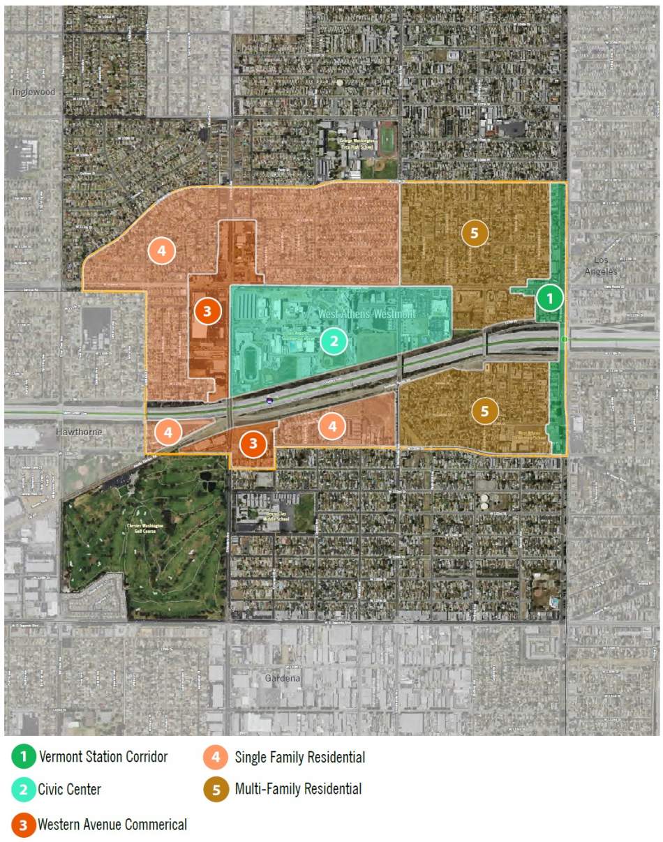
The plan, known as Connect Southwest L.A., applies to approximately 473 acres of unincorporated land located west of Vermont Avenue, flanking both sides of the I-105 freeway. It is divided into five subareas, as detailed below.
Vermont Station District
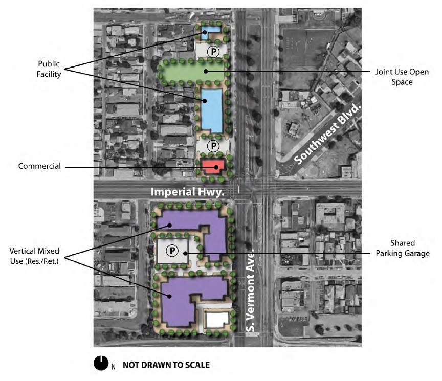
The Vermont Station District includes the properties along the west side of Vermont Avenue between 110th and 120th Streets, including the Green Line Station and a center median.
The proposed specific plan recommends several potential improvements for freeway-median rail station, including:
- Upgrading the elevators, escalators and stairs to the station.
- Improving the west station entry for safety and comfort.
- Widening the sidewalk to allow a more prominent entrance and streetscape amenities.
- Adding new bus canopies along the bridge overpass.
- Improving lighting, landscaping and signage.
The surrounding blocks - currently an array of one-story commercial buildings - are expected to be developed over time with low- and mid-rise buildings featuring a mixture of office and residential uses atop street-fronting stores and restaurants.
A number of pocket parks and urban plazas are envisioned for this district, including new passive green space within the Vermont Avenue median.
A conceptual site plan produced by the County shows what a development flanking the Metro station could look like, with buildings between three and five stories in height.
Civic Center District
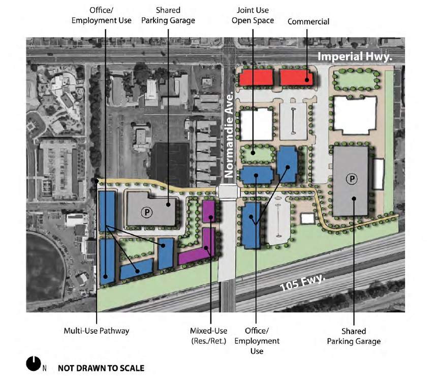
The Civic Center District - bounded by Imperial HIghway, Western Avenue, Budlong Avenue and the I-105 freeway - is currently developed with a mix instituitonal land uses. These incliude the L.A. County Probation Department and Sheriff's Department - which occupy 15 acres at the southeast corner of Normandie Avenue and Imperial Highway - and Los Angeles Southwest College - a 64-acre campus frequented by 12,000 commuter students.
The proposed specific plan points to underutilized County-owned properties at Normandie and Imperial Highway as an opportunity site for new, higher-density developments. These include residential units, commercial space, public open space and other community-serving uses.
A conceptual site plan shows what a unified project could look like, if various lots were consolidated into a single project site. This potential mixed-use project would help consolidate existing institutional uses into the surrounding community.
Buildings could rise up to six stories in height.
Western Avenue Commercial Corridor District
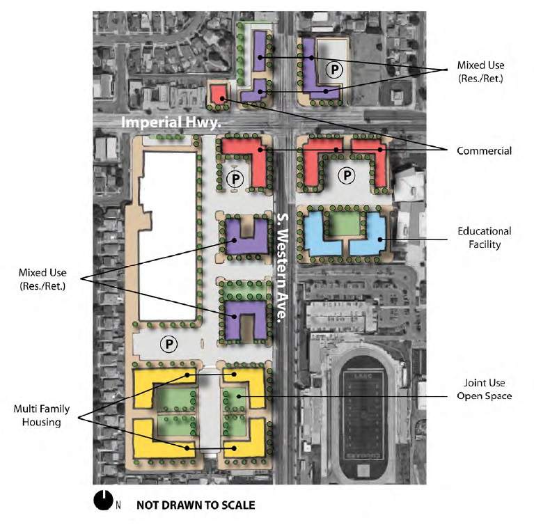
Located along Western Avenue between the I-105 freeway and 111th Street, the Western Avenue Commercial Corridor District is currently developed with traditional neighborhood-oriented commercial buildings and automobile-oriented shopping centers.
The specific plan envisions infill commercial and mixed-use developments, similar to those seen north of Imperial Highway. An existing Food for Less shopping center is cited as an opportunity site for a mixed-use center with retail, residential and employment opportunities for local residents and college students.
Buildings in this area could range up to four stories in height.
Single Family Residential District
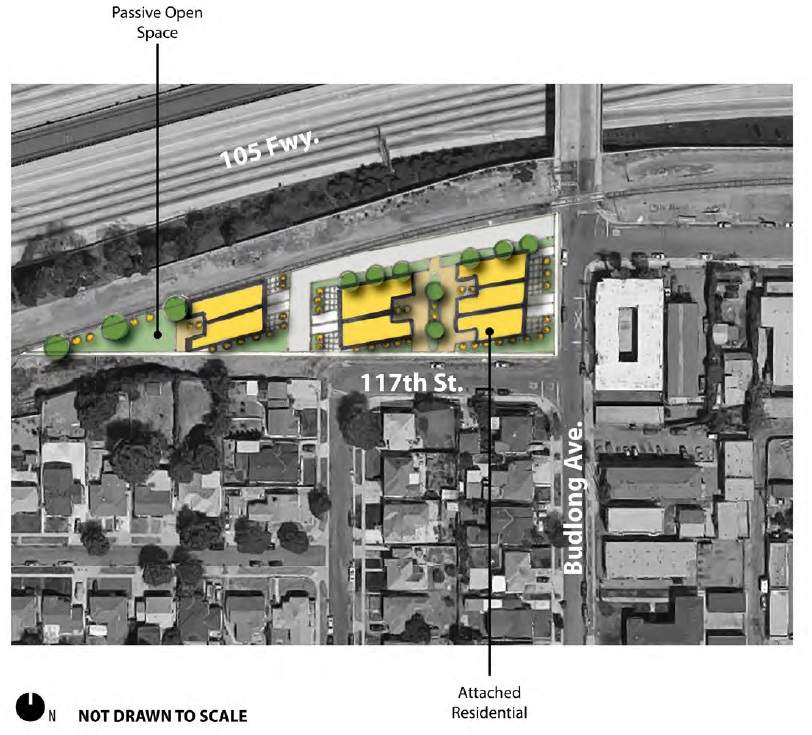
The existing single family residential zones of the specific plan are intended to be left more-or-less intact, although new housing could be added in the form of accessory dwelling units and attached townhomes.
Multi-Family Residential District
A large multi-family residential district is located within the specific plan area west of Vermont Avenue on both sides of the I-105 freeway.
The specific plan calls for continued development of multi-family housing of varying sizes within this area, promoting high-density development near transit and housing for Los Angeles Southwest College.
Mobility, Urban Design and the Public Realm
The specific plan puts forth a variety of design standards that, if implemented, would regulate building orientation and open space within the subject area. These standards are similar to those proposed for the Westlake district in Central Los Angeles, and include screened parking and street-facing entrances, amongst other regulations.
A strong emphasis is placed on first-and-last-mile connections within the specific plan area, with calls for improved pedestrian connections to stations and passenger amenities such as benches, shelters and wayfinding signage.
- Connect Southwest LA (L.A. County)


