A draft environmental impact report circulated by the City of Vernon sheds new light on a plan to rezone much of the city's westside to accommodate new housing and commercial uses.
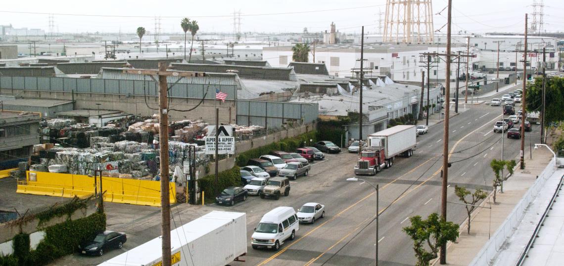
The Westside Specific Plan, which began the environmental review process roughly one year ago, is both a response to a changing real estate market in central Los Angeles County - as well as new requirements for jurisdictions across Southern California to build more housing. Vernon, which consists almost entirely of industrial uses, had just 222 residents as of the 2020 census, making it the second least populous jurisdiction in all of California.
The new land use regulations proposed in the Westside specific plan could set the stage for Vernon's population to nearly quintuple in size, rezoning a roughly 840-acre area along Alameda Street, Santa Fe Avenue, and portions of Pacific Boulevard to accommodate the construction of new mixed-use buildings, as well as the adaptive reuse of some older structures. That area, which abuts both the City of Los Angeles and the City of Huntington Park, sits just east of Metro A Line stops at Slauson and Vernon Avenues, as well as a future stop on the West Santa Ana Branch.
As currently developed, this area is home to an estimated 13 residents, 7,000 square feet of commercial space, and nearly 15 million square feet of industrial uses. By 2040, the proposed zoning regulations are expected to allow for the construction of:
- 874 residential units;
- 360,429 square feet of office/research and development; and
- 253,021 square feet of production retail.
This new construction would increase the amount of commercial space in Vernon's westside by more than 120,000 square feet, while simultaneously leading to a decrease of more than 575,000 square feet of industrial space.
Culver City-based LOHA has been tapped to for the specific plan effort, which targets four specific clusters of buildings within the 840 acre area for potential redevelopment. Between the various districts, building with maximum heights between three and five stories would be allowed which potential uses including apartments, live/work residential, shops, restaurants, media production, light industrial facilities, markets, and galleries. The "post-industrial transformation," imagined through the plan is described as being similar to that which has swept through the Arts District in nearby Downtown Los Angeles to the north.
Santa Fe Avenue, the main north-south corridor within the specific plan area, is imagined as the main pedestrian spine for the westside neighborhood, due in part to the presence of older industrial and commercial buildings with potential for reuse. The plan imagines a reduction in roadway width from two lanes in either direction to one, creating more space for street parking, bike lanes, and street trees.
The potential of Santa Fe as a pedestrian thoroughfare is also dependent on a realignment of truck traffic through Vernon. Under the specific plan, trucks would be rerouted to use Alameda Street to the west.
The draft environmental study was first circulated for comment at the end of March, and will be available for feedback through May 15. For more information on the Westside Specific Plan, visit the project's official website.
Follow us on social media:
- City of Vernon plans for residential on its westside (Urbanize LA)